I packed away my wet tarp and donned my wet clothes for the trip to Hot Springs. I did opt for a fresh pair of socks but they didn’t last 20 minutes before I was sloshing around in them. I crossed through Hurricane Gap and after a few miles came upon the Rich Mountain Lookout Tower. The trail guide shows that it’s a .1 mile climb to the tower. I beg to differ. It’s at least twice that. While this may seem inconsequential when you’re wet and tired it’s a big deal.

My Salamander Friend
Despite my misgivings I couldn’t resist the urge to explore. The sign marking the trail also told me it was well worth the effort. Surely people wouldn’t mislead me, would they? Of course not. The climb was somewhat steep and the slick mud made it a challenge. However, I crossed the forest service road to the tower and decided I’d made another good decision.

Seriously Worth It
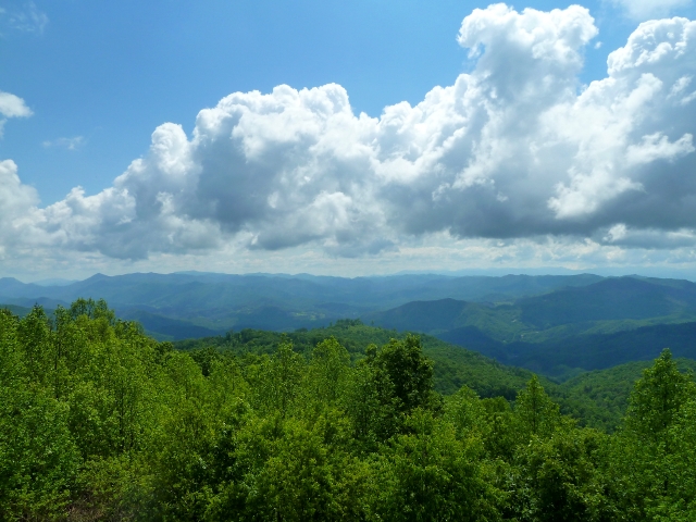
I quickly dropped the pack (backside up so it could dry) and stripped off my shoes, socks, and shirt. The tower became my clothesline and I headed up the steep stairs to the top. I was rewarded with an incredible panoramic view. The skies were clear and blue with light, puffy clouds dotting them. The mountains were bright with their green foliage and the birds were singing as they, too, enjoyed the relief from the rain.
I took the opportunity to shoot some video and take numerous pictures while atop the tower. Most of this was to give my clothes longer in the sun but also to give myself and my readers wonderful memories. People often ask me why I do what I do and it’s moments like this that provide the reason. Though my brow may be covered in sweat, my lungs craving sweet oxygen, and my muscles begging for relief the beauty one finds in these genuine mountaintop experiences defy words. I could never adequately describe to you the wonder and excitement of seeing the creations surrounding you at the top. I can only hope that my words and my pictures are enough to encourage you to see for yourself someday. Perhaps you’ll surprise yourself and get addicted as well.

View 1 from Rich Mtn Tower

View 2 from Rich Mtn Tower
As I was loading up to leave I met another hiker just out with some friends to enjoy a little bit of nature. I passed his friends as I headed back down and I know they enjoyed their lunch atop the tower. I stopped at Tanyard Gap (US 25/70) for a quick snack and was surprised when I looked back up the trail to see another hiker. I often check behind me and hadn’t seen anyone all day. I have no idea where he came from but it was as if he’d materialized out of nowhere. I couldn’t help but wonder if he were another ghost. 🙂
His name was Tumbleweed and he was an older gentleman from Pennsylvania. We both had a short break before hitting the trail again. He left a few minutes before me and said I’d probably pass him as he was a slow walker. I figured we’d end up hiking the rest of the trail together since he was headed to Davenport Gap which is located a few miles past my destination of Standing Bear Farm.
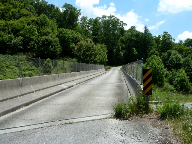
Hiking out of Tanyard Gap you cross a single lane overpass before turning back into the woods. I hiked for about a mile and never saw Tumbleweed. I hoped he hadn’t missed the turn and was still walking the paved road. Then I hoped he wasn’t really a ghost this time. As I walked off Mill Ridge Road and towards the pond I finally (guess he’s not a ghost either) passed him.

Tanyard Gap, US 25/70 Overpass

Mill Ridge

Mill Ridge Sign
The pond is formed by a dam and was much nicer and larger than I’d expected. I’d heard of it from the northbound hikers but I was expecting more of a stock pond like I was used to from my early days in South Texas. I really wanted to hike with Tumbleweed but I’d gotten a late start and was fighting the clock. I didn’t hit the trail until 10 am and needed to hit Hot Springs before 5 so I could get my box from the outfitter. I decided to push on and make a run for it.

The Pond
The last leg into Hot Springs damn near killed me. Ok, not literally, but you get my drift. My right knee started really causing me some problems. One thing about hiking this section southbound is that there seems to be a lot more downhill action than uphill. While the latter is tiring, the former can be downright brutal on your joints. In addition to providing steep descents the area surrounding Hot Springs is incredibly rocky. I found myself slowing down more and more to maintain my footing as well as trying to minimize the pain shooting through my knee.

Try Putting a Tent Here
Despite the agonizing descent, the trail afforded me some gorgeous views of the town of Hot Springs and the French Broad River. The sound of the water rushing over unseen rocks and boulders filled my ears the closer I got to town. These were welcome sights and sounds that let me see the proverbial light at the end of the tunnel.
During the planning for my trip one sight that I really wanted to see was Lovers Leap Rock. Unfortunately, with time rapidly slipping away and my forward momentum rapidly deteriorating I made the decision to forego the views. I made it into Hot Springs and Bluff Mountain Outfitters at 4:30. I’m sure I would have missed it had I taken the side trail.

Hot Springs From Above

Spying the French Broad River
